Machine Learning Transforms Satellite Wildlife Monitoring: A Study
AI | 10-07-2023 | By Liam Critchley
Africa has the greatest diversity of mammals in the world, and there are more mammals on the African continent than any other continent. However, increased levels of intensive land use for natural resource extraction (as well as hunting) have led to a large decline in animal populations across Africa. There are many protected areas for mammals all across Africa, but even in these areas, animal populations have declined by 59% in the last three decades, and many animals are now considered to be endangered or threatened by the International Union for Conservation of Nature.
1 It's important to note that the decline in animal populations is not just a concern for conservationists, but it also has significant implications for the ecosystems and human populations that depend on these animals. For instance, a study published in Nature Communications found that the decline in large herbivores can lead to an increase in the frequency of wildfires and change the structure and function of ecosystems2.
The Decline of Mammal Populations in Africa
While hunting is a separate problem of its own, intensive land use for both the development of new infrastructure and the mining of natural resources has played a key role in this decline. As climate change becomes more prevalent and impacts our local ecosystems more, it’s thought that this decline could increase further. To prevent further losses, more advanced monitoring technologies are being sought that can provide information that keeps pace with local environmental changes across Africa.
While there are already a number of techniques used, the prospect of new satellite remote sensing methods, coupled with machine learning algorithms, could offer a more efficient way of monitoring global diversity with a much higher speed and precision. The ability to monitor more efficiently could reveal new insights into the ecology of an area at much larger scales to give scientists and local reserve managers the ability to better manage entire animal populations and ecosystems.
3 The study also highlights the potential of this technology in other wildlife conservation efforts. The ability to accurately and efficiently monitor large populations of animals from space could be a game-changer for many endangered species. This technology could also be used to monitor the effects of climate change on wildlife populations, providing valuable data for conservation strategies.
The Shift from Traditional Monitoring Methods to Advanced Technologies
One of the most common methods for surveying and monitoring large wildlife populations across Africa has been to use manned aerial vessels to provide the surveys. This approach has been used for decades and has been a key aspect in developing one of the longest-running ecological databases in the world. This database has been the foundation for many conservation strategies employed across the continent.
However, in the modern digital age, where remote monitoring technologies are now commonplace, sending manned crews presents an unnecessary risk to life—especially when manned missions only provide animal counts over a rough location and are subject to biases relating to user experience (detection issues and double counting for example).
Unmanned aerial vehicles (UAVs) have been proffered as an alternative, but their short battery/fuel life limits how much they can map and will often disturb wildlife because they fly at low altitudes. Advancements in satellite technology have the potential to survey much wider landscapes of the continent to estimate the population sizes of different animals. Satellite technologies can now manually count individual animals, but they still require some level of manual intervention to achieve results. Now, with rapid advances in AI and machine learning taking place, there’s the possibility to make satellite-based monitoring systems fully automated in the hope that they are adopted more by the conversation community over manned missions.
4 The study's methodology is not without its limitations. For instance, the accuracy of the deep learning model is dependent on the quality and resolution of the satellite images. Additionally, the model's performance may be affected by the size of the animals being monitored. Larger animals like elephants and whales are easier to detect and count compared to smaller animals like wildebeest.
The study's methodology is not without its limitations. For instance, the accuracy of the deep learning model is dependent on the quality and resolution of the satellite images. Additionally, the model's performance may be affected by the size of the animals being monitored. Larger animals like elephants and whales are easier to detect and count compared to smaller animals like wildebeest."
Indeed, a study in Biological Conservation found that the use of satellite imagery and machine learning can provide accurate estimates of animal populations, even for smaller species like the wildebeest3. This technology has the potential to revolutionise the way we monitor and protect wildlife populations.

Harnessing Machine Learning for Animal Detection
Machine learning algorithms, and the sub-field of deep learning, are starting to have a big impact on monitoring platforms and for analysing large datasets with a much higher speed and accuracy. When it comes to machine vision and automation, machine learning is providing much higher capabilities than are possible through manual means—and advancements in animal detection is one area where there is a lot of potential for machine learning.
There have already been a number of collaborations where automated animal detection has taken place using satellite imagery. However, most of these have involved some of the world’s largest animals using object detection algorithms—such as whales and elephants—but these are much easier to detect than smaller animals.
Image segmentation methods have been used on some small animals, including seals and albatrosses, but these analyses were only used to categorise the animals in homogenous environments. The African continent has a range of small animals and ecosystems, so there needs to be more developments geared towards differentiating animals in different environments. For example, the wildebeest is a smaller animal but is very common and can be found in forest and savannah ecosystems, so there needs to be a better way of distinguishing smaller animals in different environments.
3 Future research could focus on improving the model's accuracy and expanding its application to other species and ecosystems. Additionally, integrating this technology with other conservation tools and strategies could enhance its effectiveness in wildlife conservation.
For example, a study published in Scientific Reports used high-resolution satellite imagery and machine learning to accurately detect and count wildebeest in the Serengeti-Mara ecosystem4. This approach could be applied to other small animals and different ecosystems, providing a more comprehensive picture of animal populations across Africa.
Case Study: Monitoring Migration in the Serengeti-Mara
This is what a recent study set out to do1, as they built a robust deep learning framework with fine-resolution satellite imagery for locating and counting wildebeest-sized animals—with body lengths of only 1.5-2.5 m—more efficiently and accurately than before. To do this, they used sub-metre resolution satellite imagery to map a wide area of the Serengeti-Mara ecosystem.
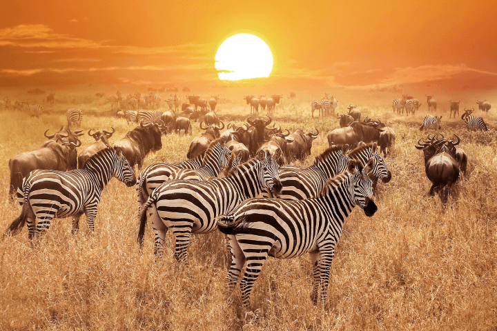
To locate the animals on the ground, the researchers integrated a clustering module with a U-Net-based deep learning model, and this process used a high-precision pixel-based image segmentation. This framework was used to locate the largest terrestrial mammal migration on the planet—the migration of white-bearded wildebeest and plains zebra across the Serengeti-Mara.
In the Serengeti-Mara, there are around 1.3 million wildebeest of varying species and over 250,000 zebras that all move across the ecosystem alongside other small animals. This migration drives processes that support the health of both humans and wildlife across the region. However, the migration is subject to seasonal changes in rainfall and habitat preference, and rapid climate change is threatening this migration, so there’s now an urgent need to effectively map populations across the region to assess the situation in the coming years.
Indeed, the study in Scientific Reports found that their deep learning model was able to accurately detect almost 500,000 individual animals across an area spanning thousands of square kilometres4. This level of detail and accuracy is unprecedented and could provide invaluable insights into animal behaviours and migration patterns.
The deep learning framework was able to locate and count large numbers of wildebeest and zebra in the Serengeti-Mara ecosystem. In terms of numbers, this deep learning approach was able to accurately detect almost 500,000 individual animals across an area spanning thousands of square kilometres, as well as showing regions where there were densely populated animals—offering a way to study the ecology of different animal aggregations. The detection algorithm was found to have an overall accuracy of 84.75%.
4 The study's findings underscore the importance of technological innovation in wildlife conservation. As the challenges facing wildlife populations continue to grow, tools like the deep learning model developed in this study will be crucial in informing and guiding conservation efforts.
Conclusion
Imaging such a large number of small animals over a wide area is relatively new for both satellite imaging and machine learning algorithms, but there are some good foundations to work with, and it’s thought that this approach could be used to detect a range of terrestrial mammals around the world. While there’s a lot of interest in monitoring numbers from an extinction perspective, there’s also the potential to use this monitoring technology to further research into different animal behaviours across different ecological systems. While there’s still some work to be done with different ecosystems and more heterogenous ecosystems, another avenue for the future could be to explore previously undocumented mammal migrations in different regions of the world.
3 The study's findings also have implications beyond wildlife conservation. The ability to monitor large populations from space could be useful in a variety of fields, from studying the effects of climate change to managing natural resources.
References
- Nature Communications. (2023). Impact of large herbivore loss on plant and animal communities in an African savanna. https://www.nature.com/articles/s41467-023-38901-y
- Global Environmental Change. (2019). The impact of land use/land cover change on ecosystem services in the central highlands of Ethiopia. https://www.sciencedirect.com/science/article/abs/pii/S0959378019308945?via%3Dihub
- Biological Conservation. (2010). Monitoring the abundance of large and medium-sized mammals with remote camera traps in the Kaa-Iya del Gran Chaco National Park. https://www.sciencedirect.com/science/article/abs/pii/S0006320710002739?via%3Dihub
- Scientific Reports. (2019). Using high-resolution satellite imagery and deep learning to detect and count African elephants in heterogeneous landscapes. https://www.nature.com/articles/s41598-019-51845-y